- Домашняя страница /
- Книги /
- Engineering & Transportation /
- Engineering /
- Computer Modelling /
- Remote Sensing & GIS /
- Introduction to Spatial Data Analysis
0 ratings





товар №:
145383070
Introduction to Spatial Data Analysis
90% of respondents would recommend this to a friend
товар №:
145383070
UZS 826122
Price Details
Excluding Shipping & Custom charges ( Shipping and custom charges will be calculated on checkout )
*All items will import from США
0 ratings
Написать отзыв
В наличии
 Импортировано из магазина USA
QTY:
На складе осталось всего 2 тов.
Закажите сейчас и получите товар приблизительно Monday, Октябрь 19
Secured transaction
Ubuy works hard to protect your security and privacy. Our advanced payment security system ensures confidentiality by encrypting your information during transmission using AES (Advanced Encryption Standards) and SSL (Secure Socket Layer) protocols. Your payment details are 100% secure as we do not share your payment details with third party sellers.
Our Top Logistics Partners


Fast
Shipping

Free
Return*

Secure Packaging

100% Original Products

PCI DSS Compliance

ISO 27001 Certified



Note: Step Down Voltage Transformer required for using electronics products of США store (110-120). Recommended power converters Купите сейчас.


Информация о продукте
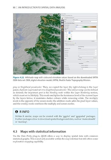
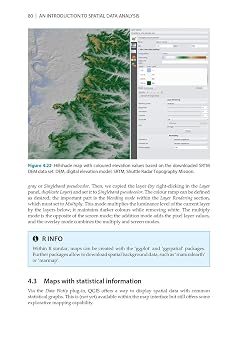
- This is a book about how environmental scientist can integrate remote sensing and GIS in their research. It will allow readers to get started with the application of remote sensing as well as GIS and to understand its potential and limitations. Using practical examples, the book covers all necessary steps from planning field campaigns to deriving relevant environmental information through remote sensing and modelling of species distributions.This book introduces spatial data handling using the open source software Quantum GIS (QGIS). In addition, readers will be guided through their first steps in the R programming language. The authors explain the fundamentals of spatial data handling and analysis, empowering the reader to turn data acquired in the field into actual spatial data. Readers will learn to process and analyse spatial data of different types and interpret the data and results. After finishing this book, readers will be able to address questions such as What is the distance to the border of the protected area?, Which points are located close to a road?, Which fraction of land cover types exist in my study area? using different software and techniques. This book is for novice spatial data users and does not assume any prior knowledge of spatial data itself or practical experience working with such data sets. Readers will likely include student and professional ecologists, geographers and any environmental scientists or practitioners who need to collect, visualize and analyse spatial data. The software used will be the widely applied open source scientific programs QGIS and R. All scripts and data sets used in the book will be provided online at book.ecosens.org. This book covers specific methods including:* what to consider before collecting in situ data* how to work with spatial data collected in situ* the difference between raster and vector data* how to acquire further vector and raster data* how to create relevant environmental information* how to combine and analyse in situ and remote sensing data* how to create useful maps for field work and presentations* how to use QGIS and R for spatial analysis* how to develop analysis scripts
| Publisher | Pelagic |
| Publication date | November 7, 2020 |
| Language | English |
| Print length | 300 pages |
| ISBN-10 | 1784272132 |
| ISBN-13 | 978-1784272135 |
| Item Weight | 1.1 pounds (500 grams) |
| Dimensions | 6.76 x 0.43 x 9.68 inches (17.2 x 1.1 x 24.6 cm) |
| Part of series | Data in the Wild |
ОПИСАНИЕ ТОВАРА
Introduction to Spatial Data Analysis
Есть вопрос? Пообщайтесь с нами в чате
Вопросы и ответы клиентов
-
вопрос:
Как покупать Introduction to Spatial Data Analysis в Интернете на Ubuy?
отвечать: Купить Introduction to Spatial Data Analysis онлайн на Ubuy очень просто.. Вам просто нужно найти товар, выбрать способ доставки при оформлении заказа и получить его до вашего места. -
вопрос:
Доступен ли Introduction to Spatial Data Analysis для покупок в Интернете в Uzbekistan?
отвечать: Да, на Ubuy Uzbekistan вы можете купить этот товар по разумной цене.. Introduction to Spatial Data Analysis недоступен на месте, но вы можете доверить нам наши услуги экспресс-доставки. -
вопрос:
Сколько времени занимает получение товара после размещения заказа?
отвечать: Время доставки заказанного вами товара зависит от того, что вы заказали, и выбранного вами способа доставки.. Ориентировочное время доставки указывается в процессе оформления заказа, так что будьте беззаботны при совершении покупок.
Remote Sensing & GIS Editorial Review
Редакционных отзывов не найдено
Customer Reviews & Ratings
11 оценки клиентов
-
5 звезда
76%
-
4 звезда
0%
-
3 звезда
12%
-
2 звезда
12%
-
1 звезда
0%
Оцените этот товар
Поделитесь своими впечатлениями
Customers also viewed these products


Product Price History
Важная информация
- Ограничения: обратите внимание, что для товаров, поставляемых за границу, гарантия производителя может быть недействительной; обслуживание от производителя может быть недоступно; руководства по эксплуатации, а также инструкции и предупреждения о безопасности могут быть не на языках страны назначения; товары (и сопутствующие материалы) могут не быть разработаны в соответствии со стандартами, спецификациями и требованиями к маркировке страны назначения; товары также могут не соответствовать напряжению в стране назначения и другим электрическим стандартам (при необходимости требуется использование адаптера или преобразователя). Получатель несет ответственность за обеспечение законного ввоза товара в страну назначения. При заказе через Ubuy или его аффилированных лиц получатель является зарегистрированным импортером и должен соблюдать все законы и правила страны назначения.
- Не все товары на Ubuy выставлены на продажу, поскольку Ubuy — это глобальная поисковая система. На товары распространяются законы в области экспорта и торговли.
UZS 826122
Закажите сейчас и получите товар приблизительно Monday, Октябрь 19
This item is not restrict in my country.(Please click on above link if this item is not restrict in your country, So our team will review and allow.)
QTY:
На складе осталось всего 2 тов.
Secured transaction
PCI DSS compliant and ISO 27001:2022 certified, with encrypted payments and full buyer protection on every order.
Our Top Logistics Partners
Fastest cross-border delivery
Ubuy Assurance
Experience worry-free shopping with 100% original products, PCI DSS-compliant payment security, ISO 27001-certified data protection, the fastest cross-border delivery, free returns *, and secure packaging on every order.